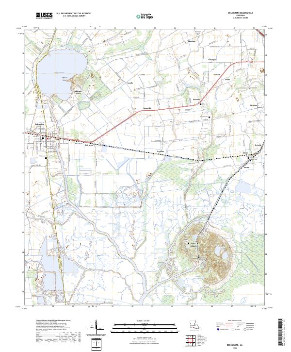
2024 Map of Delcambre
USGS Topo · Published 2024About this map
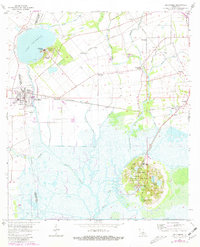
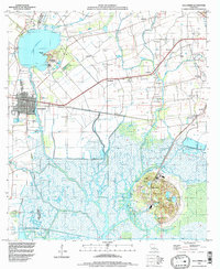
Lake Peigneur and the salt dome heights of Jefferson Island and Avery Island anchor this survey of the South Louisiana lowlands. The landscape is defined by its complex hydrology, where natural waterways like Bayou Tigre meet an engineered network of drainage and navigation, including the Norris Branch Canal and Delcambre Canal. The town of Delcambre sits at the western edge of the quadrangle along the BNSF Railway, serving as a hub for the surrounding rural communities such as Leleux, Brousville, and Rynella.
Find a feature on this map
120 named features on this map. Tap any name to fly to it.
Don’t see what you’re looking for? This feature index may not catch every label — zoom into the map to look around manually.
Map Details
Editions of this 2024 Delcambre Map
This is the sole edition of this map. No revisions or reprints were ever made.
Historical Maps of Delcambre Through Time
3 maps found