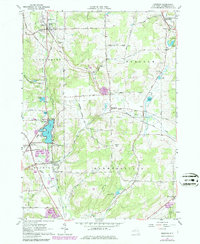
1963 Map of Delevan
USGS Topo · Published 1979About this map
The dairy lands and wooded hills of northern Cattaraugus County are captured here at a time when traditional village life and rural industry intersected with modern transportation. Lime Lake serves as a focal point for local geography, with the County Infirmary and the village of Machias situated along its southern and western shores. The landscape is defined by its topographic high points, including Pigeon Hill and Cheeseman Hill, which overlook a network of small settlements and dairy farms.
Find a feature on this map
56 named features on this map. Tap any name to fly to it.
Don’t see what you’re looking for? This feature index may not catch every label — zoom into the map to look around manually.
Map Details
Editions of this 1963 Delevan Map
3 editions found
Other maps of this area

1923 · Arcade
USGS Topo · 1:62,500

1924 · Ellicottville
USGS Topo · 1:62,500

1924 · Franklinville
USGS Topo · 1:62,500

1925 · Springville
USGS Topo · 1:62,500

1925 · Arcade
USGS Topo · 1:62,500

1941 · Ellicottville
USGS Topo · 1:62,500

1942 · Franklinville
USGS Topo · 1:62,500

1957 · Sardinia
USGS Topo · 1:24,000

1960 · Buffalo
USGS Topo · 1:250,000

1962 · Buffalo
USGS Topo · 1:250,000