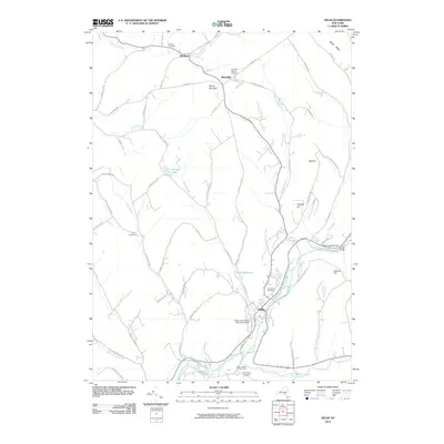
2010 Map of Delhi
USGS Topo · Published 2010About this map
The West Branch Delaware River flows through this Catskill mountain region, anchoring the village of Delhi. This 2010 landscape shows the significant footprint of the State University of New York at Delhi, situated just west of the river near the historic Woodland Cemetery. Upstream, the Fitches Covered Bridge remains a prominent landmark near Watauga Falls, reflecting the area's preserved architectural heritage.
Find a feature on this map
67 named features on this map. Tap any name to fly to it.
Don’t see what you’re looking for? This feature index may not catch every label — zoom into the map to look around manually.
Map Details
Editions of this 2010 Delhi Map
This is the sole edition of this map. No revisions or reprints were ever made.
Other maps of this area

1909 · Delhi
USGS Topo · 1:62,500

1911 · Delhi
USGS Topo · 1:62,500

1915 · Oneonta
USGS Topo · 1:62,500

1918 · Oneonta
USGS Topo · 1:62,500

1922 · Andes
USGS Topo · 1:62,500

1923 · Walton
USGS Topo · 1:48,000

1924 · Andes
USGS Topo · 1:62,500

1925 · Walton
USGS Topo · 1:62,500

1943 · Delhi
USGS Topo · 1:24,000

1943 · Bloomville
USGS Topo · 1:24,000