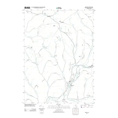
2013 Map of Delhi
USGS Topo · Published 2013About this map
The town of Delhi sits at the confluence of several vital waterways in Delaware County, where the West Br Delaware River meets Steele Brook and the Little Delaware River. This 2013 survey illustrates the area's agricultural character, preserved in named properties like Slope Farms, West Wind Farm, and the Betty Acres Organic Farm. Local history is deeply etched into the hillsides, with numerous small burial grounds such as Meredith Square Cem, Mertins Cem, and the Old Scotch Cem scattered near the settlements of Meridale and Meredith. Significant landmarks including the Fitches Covered Bridge near East Delhi and the Mason Airway Airport to the west reflect a landscape that balances traditional Catskill mountain infrastructure with modern utility. The map also traces various ridges and peaks, from Rattail Ridge in the northeast to the prominent Federal Hill overlooking the river valley.
Find a feature on this map
100 named features on this map. Tap any name to fly to it.
Don’t see what you’re looking for? This feature index may not catch every label — zoom into the map to look around manually.
Map Details
Editions of this 2013 Delhi Map
This is the sole edition of this map. No revisions or reprints were ever made.
Other maps of this area

1909 · Delhi
USGS Topo · 1:62,500

1911 · Delhi
USGS Topo · 1:62,500

1915 · Oneonta
USGS Topo · 1:62,500

1918 · Oneonta
USGS Topo · 1:62,500

1922 · Andes
USGS Topo · 1:62,500

1923 · Walton
USGS Topo · 1:48,000

1924 · Andes
USGS Topo · 1:62,500

1925 · Walton
USGS Topo · 1:62,500

1943 · Delhi
USGS Topo · 1:24,000

1943 · Bloomville
USGS Topo · 1:24,000