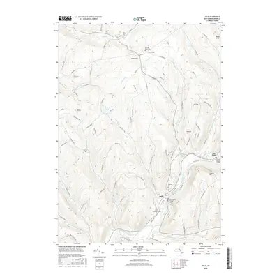
2016 Map of Delhi
USGS Topo · Published 2016About this map
The village of Delhi sits at the confluence of the West Branch Delaware River and Steele Brook, serving as a central hub for this portion of Delaware County. This 2016 survey highlights the significant institutional footprint of the SUNY Coll of Technology at Delhi, which occupies much of the valley floor west of the river. The surrounding landscape is defined by high ridges like Federal Hill and Hollister Hill, separated by a network of drainage basins including Honest Brook and Treadwell Cr.
Find a feature on this map
96 named features on this map. Tap any name to fly to it.
Don’t see what you’re looking for? This feature index may not catch every label — zoom into the map to look around manually.
Map Details
Editions of this 2016 Delhi Map
This is the sole edition of this map. No revisions or reprints were ever made.
Other maps of this area

1909 · Delhi
USGS Topo · 1:62,500

1911 · Delhi
USGS Topo · 1:62,500

1915 · Oneonta
USGS Topo · 1:62,500

1918 · Oneonta
USGS Topo · 1:62,500

1922 · Andes
USGS Topo · 1:62,500

1923 · Walton
USGS Topo · 1:48,000

1924 · Andes
USGS Topo · 1:62,500

1925 · Walton
USGS Topo · 1:62,500

1943 · Delhi
USGS Topo · 1:24,000

1943 · Bloomville
USGS Topo · 1:24,000