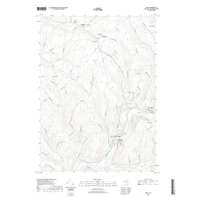
2019 Map of Delhi
USGS Topo · Published 2019About this map
Delhi and the upper reaches of the West Branch Delaware River anchor this topographic view of Delaware County. The landscape is defined by the convergence of several major tributaries, including Little Delaware River, Steele Brook, and Falls Creek, which flow through steep-sided valleys between ridges like Big Tom and Hollister Hill. The village of Delhi serves as a clear jurisdictional and cultural center, featuring the Delaware County Courthouse and numerous burial grounds such as Woodland Cem. Historical landmarks of the river-crossing era are preserved here, notably the Fitches Covered Bridge near East Delhi and the Christian Church Cem at Fitch's Bridge. Smaller hamlets like Meridale and Meredith to the north are connected by a network of rural routes such as Palmer Hill Rd and Turnpike Rd, reflecting a settlement pattern deeply influenced by the area's complex hydrology and elevated terrain.
Find a feature on this map
107 named features on this map. Tap any name to fly to it.
Don’t see what you’re looking for? This feature index may not catch every label — zoom into the map to look around manually.
Map Details
Editions of this 2019 Delhi Map
This is the sole edition of this map. No revisions or reprints were ever made.
Other maps of this area

1909 · Delhi
USGS Topo · 1:62,500

1911 · Delhi
USGS Topo · 1:62,500

1915 · Oneonta
USGS Topo · 1:62,500

1918 · Oneonta
USGS Topo · 1:62,500

1922 · Andes
USGS Topo · 1:62,500

1923 · Walton
USGS Topo · 1:48,000

1924 · Andes
USGS Topo · 1:62,500

1925 · Walton
USGS Topo · 1:62,500

1943 · Delhi
USGS Topo · 1:24,000

1943 · Bloomville
USGS Topo · 1:24,000