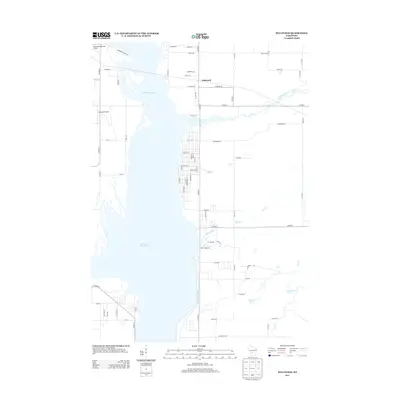
2013 Map of Dellwood
USGS Topo · Published 2013About this map
Castle Rock Lake dominates the western half of this landscape, a significant reservoir that reshaped the geography of Adams County. The settlement of Dellwood sits along its eastern shoreline, organized by a dense grid of streets including Market St, Town Rd, and Grove Ave. This residential pocket contrasts with the more rural, wooded areas to the east, where agricultural and water management features like Castle Rock Ditch and the 17 Reservoir appear. Two private airfields, Murmuring Springs Airport and Accurate Airport, serve the lakeside community. Waterways such as Little Roche a Cri Creek and Klein Creek feed into the lake, illustrating the drainage patterns of the Central Wisconsin River valley during the early 21st century.
Find a feature on this map
68 named features on this map. Tap any name to fly to it.
Don’t see what you’re looking for? This feature index may not catch every label — zoom into the map to look around manually.
Map Details
Editions of this 2013 Dellwood Map
This is the sole edition of this map. No revisions or reprints were ever made.
Other maps of this area

1921 · Mauston
USGS Topo · 1:62,500

1953 · Eau Claire
USGS Topo · 1:250,000

1955 · Green Bay
USGS Topo · 1:250,000

1957 · Madison
USGS Topo · 1:250,000

1958 · Eau Claire
USGS Topo · 1:250,000

1958 · Arkdale
USGS Topo · 1:48,000

1958 · Necedah
USGS Topo · 1:48,000

1958 · La Crosse
USGS Topo · 1:250,000

1960 · Madison
USGS Topo · 1:250,000

1961 · La Crosse
USGS Topo · 1:250,000