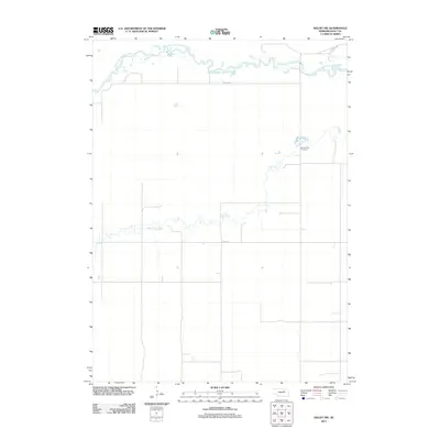
2011 Map of Deloit NW
USGS Topo · Published 2011About this map
The South Fork Elkhorn River meanders across the northern reaches of this Holt County landscape, defining the local hydrology alongside the winding path of Cache Creek. This region is characterized by a sparse, grid-like road network including Co Rd-2260 and 852nd Rd, which serve the agricultural plots and rural homesteads of the Nebraska plains. A significant landmark for local historians and genealogists is the Vandersnick Cemetery, situated on the eastern side of the quadrangle. The map illustrates the subtle drainage patterns where smaller tributaries feed into the larger river system, reflecting the quiet, rural character of the Nebraska interior during the early twenty-first century.
Find a feature on this map
5 named features on this map. Tap any name to fly to it.
Don’t see what you’re looking for? This feature index may not catch every label — zoom into the map to look around manually.
Map Details
Editions of this 2011 Deloit NW Map
This is the sole edition of this map. No revisions or reprints were ever made.
Other maps of this area

1955 · O'Neill
USGS Topo · 1:250,000

1959 · O'Neill
USGS Topo · 1:250,000

1963 · Deloit
USGS Topo · 1:24,000

1963 · Ewing SW
USGS Topo · 1:24,000

1963 · Deloit SW
USGS Topo · 1:24,000

1963 · Ewing
USGS Topo · 1:24,000

1963 · Deloit NE
USGS Topo · 1:24,000

1963 · Deloit NW
USGS Topo · 1:24,000

1964 · O'Neill SE
USGS Topo · 1:24,000

1969 · O'Neill
USGS Topo · 1:250,000