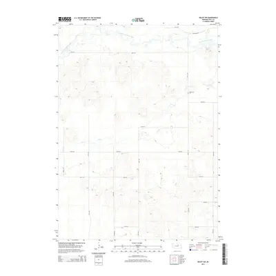
2014 Map of Deloit NW
USGS Topo · Published 2014About this map
The South Fork Elkhorn River meanders across the northern reaches of this Holt County landscape, defining the local drainage pattern before it gives way to the undulating terrain of the Nebraska Sandhills. This 2014 survey reveals a land primarily organized by the section-line grid, where gravel routes like Wellington Rd and 857th Rd connect isolated homesteads. The central and southern portions of the map are characterized by intricate topographic contours representing stabilized dunes and depressions, through which Cache Cr carves a narrow path. Genealogists and local historians will find the Vandersnick Cem as a primary point of interest along 505th Ave, serving as a silent anchor for the families who settled this rural expanse.
Find a feature on this map
18 named features on this map. Tap any name to fly to it.
Don’t see what you’re looking for? This feature index may not catch every label — zoom into the map to look around manually.
Map Details
Editions of this 2014 Deloit NW Map
This is the sole edition of this map. No revisions or reprints were ever made.
Other maps of this area

1955 · O'Neill
USGS Topo · 1:250,000

1959 · O'Neill
USGS Topo · 1:250,000

1963 · Deloit
USGS Topo · 1:24,000

1963 · Ewing SW
USGS Topo · 1:24,000

1963 · Deloit SW
USGS Topo · 1:24,000

1963 · Ewing
USGS Topo · 1:24,000

1963 · Deloit NE
USGS Topo · 1:24,000

1963 · Deloit NW
USGS Topo · 1:24,000

1964 · O'Neill SE
USGS Topo · 1:24,000

1969 · O'Neill
USGS Topo · 1:250,000