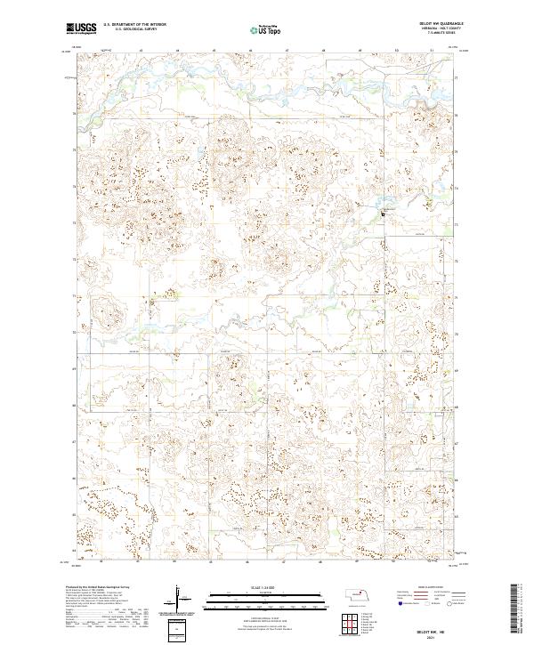
2021 Map of Deloit NW
USGS Topo · Published 2021About this map
South Fork Elkhorn River winds across the northern reaches of this Holt County landscape, defining a riparian corridor through a region marked by section lines and rural homesteads. The terrain is characterized by the complex drainage of Cache Cr, which meanders through the central and southern portions of the quadrangle. For those researching family history in the area, the Vandersnick Cem stands as a primary landmark, situated near the intersection of 854th Rd and 505 Ave. The map illustrates a strictly organized grid of county roads, such as 501st Ave and 852nd Rd, which provide access to the agricultural parcels within the townships of t26n r10w and t26n r9w. This layout reflects the enduring influence of the Public Land Survey System on the modern Nebraska prairie.
Find a feature on this map
19 named features on this map. Tap any name to fly to it.
Don’t see what you’re looking for? This feature index may not catch every label — zoom into the map to look around manually.
Map Details
Editions of this 2021 Deloit NW Map
This is the sole edition of this map. No revisions or reprints were ever made.
Other maps of this area

1955 · O'Neill
USGS Topo · 1:250,000

1959 · O'Neill
USGS Topo · 1:250,000

1963 · Deloit
USGS Topo · 1:24,000

1963 · Ewing SW
USGS Topo · 1:24,000

1963 · Deloit SW
USGS Topo · 1:24,000

1963 · Ewing
USGS Topo · 1:24,000

1963 · Deloit NE
USGS Topo · 1:24,000

1963 · Deloit NW
USGS Topo · 1:24,000

1964 · O'Neill SE
USGS Topo · 1:24,000

1969 · O'Neill
USGS Topo · 1:250,000