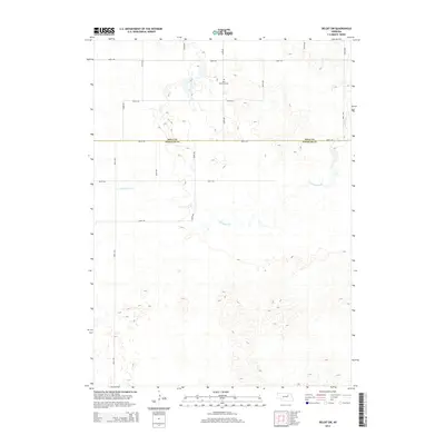
2014 Map of Deloit SW
USGS Topo · Published 2014About this map
The Saint Anthonys Cem sits as a quiet landmark near the northern edge of this Nebraska landscape, providing a specific point of interest for genealogists and local historians. The terrain is defined by the winding course of Clearwater Cr, which meanders through a network of section-line roads including 500th Ave and 846th Rd. This survey documents the rural boundary where Holt Co meets Wheeler Co, illustrating a land-use pattern dominated by agriculture and sparsely populated prairie. The grid of local routes like Timber Rd and 506th Ave highlights the structured development of the Sandhills region, where water sources like Clearwater Creek historically dictated the placement of homesteads and transportation corridors.
Find a feature on this map
17 named features on this map. Tap any name to fly to it.
Don’t see what you’re looking for? This feature index may not catch every label — zoom into the map to look around manually.
Map Details
Editions of this 2014 Deloit SW Map
This is the sole edition of this map. No revisions or reprints were ever made.
Other maps of this area

1954 · Bartlett
USGS Topo · 1:24,000

1955 · Broken Bow
USGS Topo · 1:250,000

1955 · O'Neill
USGS Topo · 1:250,000

1956 · Broken Bow
USGS Topo · 1:250,000

1959 · O'Neill
USGS Topo · 1:250,000

1960 · Spalding 2 NW
USGS Topo · 1:24,000

1960 · Spalding 2 NE
USGS Topo · 1:24,000

1963 · Deloit
USGS Topo · 1:24,000

1963 · Deloit SW
USGS Topo · 1:24,000

1963 · Deloit NE
USGS Topo · 1:24,000