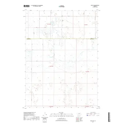
2017 Map of Deloit SW
USGS Topo · Published 2017About this map
Saint Anthonys Cem stands as a focal point of this northern Nebraska landscape, located just south of 848th Rd. This terrain, straddling the Holt Co Wheeler Co boundary, is characterized by its intricate drainage patterns and wetlands. The meandering course of Clearwater Cr winds through the central portion of the map, illustrating the slow movement of water through this low-lying region. The area is surveyed into a rigid grid of local roads, such as Timber Ave and 500th Ave, which cut across the natural marshy depressions. This contrast between the geometric human planning and the fluid, shifting hydrology of the Sandhills region highlights the challenges of settlement in such a water-saturated environment.
Find a feature on this map
26 named features on this map. Tap any name to fly to it.
Don’t see what you’re looking for? This feature index may not catch every label — zoom into the map to look around manually.
Map Details
Editions of this 2017 Deloit SW Map
This is the sole edition of this map. No revisions or reprints were ever made.
Other maps of this area

1954 · Bartlett
USGS Topo · 1:24,000

1955 · Broken Bow
USGS Topo · 1:250,000

1955 · O'Neill
USGS Topo · 1:250,000

1956 · Broken Bow
USGS Topo · 1:250,000

1959 · O'Neill
USGS Topo · 1:250,000

1960 · Spalding 2 NW
USGS Topo · 1:24,000

1960 · Spalding 2 NE
USGS Topo · 1:24,000

1963 · Deloit
USGS Topo · 1:24,000

1963 · Deloit SW
USGS Topo · 1:24,000

1963 · Deloit NE
USGS Topo · 1:24,000