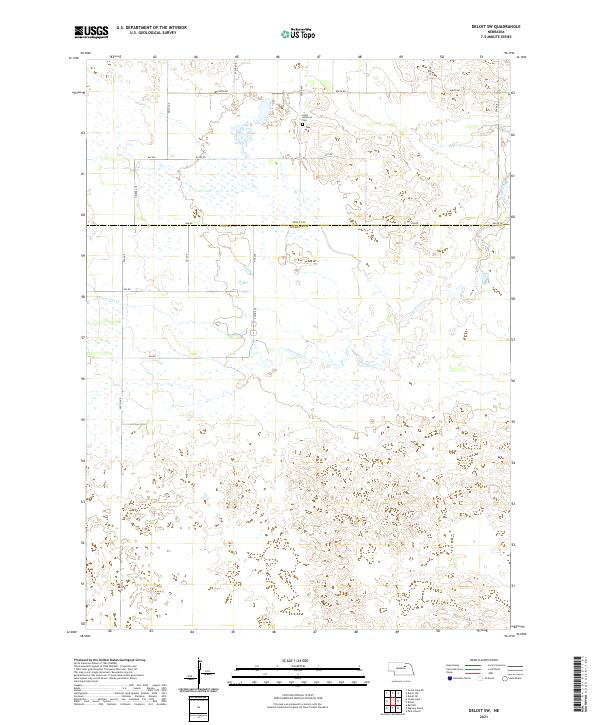
2021 Map of Deloit SW
USGS Topo · Published 2021About this map
Saint Anthonys Cem sits near the northern boundary of Wheeler County, serving as a quiet landmark in a landscape defined by its wetland patterns and drainage basins. This area of the Sandhills is marked by the meandering path of Clearwater Cr, which flows through the northwestern sections of the quadrangle. The map documents a sparse, rural grid of section lines and county roads, such as 848th Rd and 500th Ave, that navigate a complex terrain of depressions and low rises. The transition across the Holt Co Wheeler Co line shows how the local infrastructure was established to serve the isolated ranches and agricultural interests of the region. This 2021 update captures the modern persistence of these rural routes, including named tracks like Timber Ave, which provide the primary access to this interior portion of the Nebraska plains.
Find a feature on this map
26 named features on this map. Tap any name to fly to it.
Don’t see what you’re looking for? This feature index may not catch every label — zoom into the map to look around manually.
Map Details
Editions of this 2021 Deloit SW Map
This is the sole edition of this map. No revisions or reprints were ever made.
Other maps of this area

1954 · Bartlett
USGS Topo · 1:24,000

1955 · Broken Bow
USGS Topo · 1:250,000

1955 · O'Neill
USGS Topo · 1:250,000

1956 · Broken Bow
USGS Topo · 1:250,000

1959 · O'Neill
USGS Topo · 1:250,000

1960 · Spalding 2 NW
USGS Topo · 1:24,000

1960 · Spalding 2 NE
USGS Topo · 1:24,000

1963 · Deloit
USGS Topo · 1:24,000

1963 · Deloit SW
USGS Topo · 1:24,000

1963 · Deloit NE
USGS Topo · 1:24,000