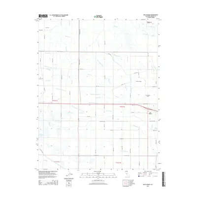
2015 Map of Delta Ranch
USGS Topo · Published 2015About this map
Delta Ranch and the small community of Dos Palos Y anchor this landscape in the heart of the San Joaquin Valley, where water management defines every acre. The complex network of irrigation and drainage is striking, with the San Joaquin River and Salt Slough winding through the northeast while engineered waterways like the Lone Tree Canal, Agatha Canal, and Colony Main Canal distribute water across the valley floor. The map reveals the meticulous grid of rural roads, such as Henry-Miller-Rd and Santa Fe Grade, which serve the expansive agricultural tracts. This 2015 edition captures the area's continued reliance on an intricate system of ditches and drains, including the Boundary Drain Number One and Toscano Ditch, illustrating how the Central Valley environment is fundamentally shaped by hydrologic engineering and large-scale ranching operations.
Find a feature on this map
77 named features on this map. Tap any name to fly to it.
Don’t see what you’re looking for? This feature index may not catch every label — zoom into the map to look around manually.
Map Details
Editions of this 2015 Delta Ranch Map
This is the sole edition of this map. No revisions or reprints were ever made.
Other maps of this area

1913 · Panoche
USGS Topo · 1:125,000

1916 · Santa Rita Bridge
USGS Topo · 1:24,000

1916 · Delta Ranch
USGS Topo · 1:24,000

1918 · Sandy Mush
USGS Topo · 1:31,680

1918 · Turner Ranch
USGS Topo · 1:31,680

1919 · San Luis Ranch
USGS Topo · 1:31,680

1920 · Santa Rita Bridge
USGS Topo · 1:31,680

1921 · Los Banos
USGS Topo · 1:31,680

1922 · Oxalis
USGS Topo · 1:31,680

1922 · Santa Rita Bridge
USGS Topo · 1:31,680