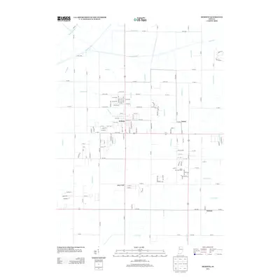
2013 Map of DeMotte
USGS Topo · Published 2013About this map
DeMotte and its surrounding agricultural plains define this region of Jasper County, characterized by an extensive network of engineered drainage that transformed the landscape. To the north, the Kankakee River follows a course parallel to Dike Rd, while a complex system of waterways including Brown Levee Ditch, Tyler Ditch, and Hodge Ditch manages the water table across the prairie. This infrastructure allowed for the development of settlements like Kersey, Deer Park, and Kniman, which are linked by a grid of rural roads such as Co Rd-1000S and W 1400 N. The map reveals the modern transition from purely agricultural use to residential pockets, seen in the street layout of DeMotte and the presence of the Shady Pines Golf Course further south. The naming conventions of the drainage ditches, such as Wesner Ditch and Hobbs Ditch, likely reflect the lineage of the local families who originally settled and reclaimed these lands.
Find a feature on this map
116 named features on this map. Tap any name to fly to it.
Don’t see what you’re looking for? This feature index may not catch every label — zoom into the map to look around manually.
Map Details
Editions of this 2013 DeMotte Map
This is the sole edition of this map. No revisions or reprints were ever made.
Other maps of this area

1953 · Leroy
USGS Topo · 1:24,000

1953 · Hebron
USGS Topo · 1:24,000

1953 · Kouts
USGS Topo · 1:24,000

1953 · Chicago
USGS Topo · 1:250,000

1957 · Chicago
USGS Topo · 1:250,000

1957 · Wheatfield
USGS Topo · 1:24,000

1957 · DeMotte
USGS Topo · 1:24,000

1959 · Shelby
USGS Topo · 1:24,000

1962 · Gifford
USGS Topo · 1:24,000

1962 · Parr
USGS Topo · 1:24,000