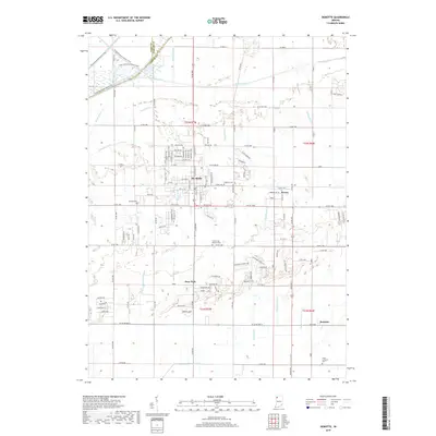
2019 Map of DeMotte
USGS Topo · Published 2019About this map
De Motte serves as the primary hub of this northern Jasper County landscape, situated at the intersection of a sprawling network of agricultural drainage channels. These waterworks, including Hodge Ditch, Sargent Ditch, and Tyler Ditch, define the region's character, reflecting a long history of converting the native wetlands into productive land. To the northwest, the Grand Kankakee Marsh Trails provide a physical link to the area's ecological past along the Brown Levee Ditch and the border with Lake and Porter Counties.
Find a feature on this map
83 named features on this map. Tap any name to fly to it.
Don’t see what you’re looking for? This feature index may not catch every label — zoom into the map to look around manually.
Map Details
Editions of this 2019 DeMotte Map
This is the sole edition of this map. No revisions or reprints were ever made.
Other maps of this area

1953 · Leroy
USGS Topo · 1:24,000

1953 · Hebron
USGS Topo · 1:24,000

1953 · Kouts
USGS Topo · 1:24,000

1953 · Chicago
USGS Topo · 1:250,000

1957 · Chicago
USGS Topo · 1:250,000

1957 · Wheatfield
USGS Topo · 1:24,000

1957 · DeMotte
USGS Topo · 1:24,000

1959 · Shelby
USGS Topo · 1:24,000

1962 · Gifford
USGS Topo · 1:24,000

1962 · Parr
USGS Topo · 1:24,000