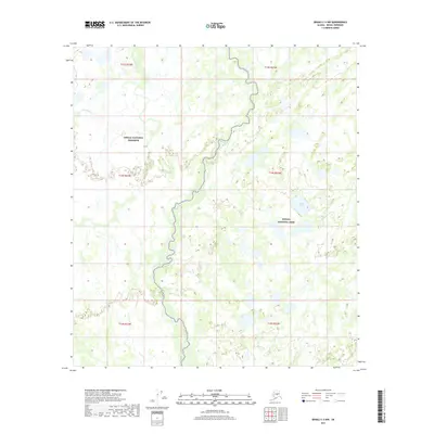
2017 Map of Denali C-4 NW
USGS Topo · Published 2017About this map
Denali National Preserve and Denali National Park meet in this 2017 survey, where a complex network of waterways defines the landscape. The winding course of Birch Creek meanders north-to-south through the center of the quadrangle, carving a path through the wetland terrain. This environment is characterized by numerous small ponds and lakes, including Corner Lake in the eastern section, which suggest a seasonal pulse of water and sediment across the tundra. In the northwest, Hot Slough indicates the presence of side channels and overflow paths common to this subarctic river system. The map serves as a detailed record of these aquatic features within the federal protected lands, showing the intricate hydrology that supports the region's wilderness character.
Find a feature on this map
11 named features on this map. Tap any name to fly to it.
Don’t see what you’re looking for? This feature index may not catch every label — zoom into the map to look around manually.
Map Details
Editions of this 2017 Denali C-4 NW Map
This is the sole edition of this map. No revisions or reprints were ever made.
Other maps of this area

1952 · Mount McKinley
USGS Topo · 1:250,000

1953 · Mount McKinley C-5
USGS Topo · 1:63,360

1953 · Mount McKinley D-5
USGS Topo · 1:63,360

1953 · Mount McKinley C-4
USGS Topo · 1:63,360

1953 · Mount McKinley D-4
USGS Topo · 1:63,360

1954 · Mount McKinley C-4
USGS Topo · 1:63,360

1954 · Mount McKinley D-4
USGS Topo · 1:63,360

1954 · Mount McKinley D-5
USGS Topo · 1:63,360

1954 · Mount McKinley C-5
USGS Topo · 1:63,360

1958 · Mount McKinley
USGS Topo · 1:250,000