
1953 Map of Mount McKinley D-5
USGS Topo · Published 1965About this map
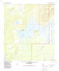
The Geographic Center of Alaska is the defining landmark of this 1953 survey, situated near the marshy confluence of the Foraker River and Muddy River. The landscape is dominated by the expansive Lake Minchumina, a major interior water body featuring Moose Island and the prominent Yutokh Hill on its eastern shore. At this time, the settlement of Lake Minchumina served as a remote outpost, supported by a designated Landing Area for bush pilots and a network of seasonal transport routes labeled as Sled Road.
Find a feature on this map
31 named features on this map. Tap any name to fly to it.
Don’t see what you’re looking for? This feature index may not catch every label — zoom into the map to look around manually.
Map Details
Editions of this 1953 Mount McKinley D-5 Map
2 editions found
Other maps of this area

1948 · Kantishna River
USGS Topo · 1:250,000

1951 · Kantishna River
USGS Topo · 1:250,000

1952 · Mount McKinley
USGS Topo · 1:250,000

1952 · Kantishna River
USGS Topo · 1:250,000

1952 · Kantishna River A-5
USGS Topo · 1:63,360

1952 · Kantishna River A-6
USGS Topo · 1:63,360

1953 · Mount McKinley C-5
USGS Topo · 1:63,360

1953 · Kantishna River A-4
USGS Topo · 1:63,360

1953 · Mount McKinley C-4
USGS Topo · 1:63,360

1953 · Mount McKinley D-4
USGS Topo · 1:63,360