
1953 Map of Kantishna River A-4
USGS Topo · Published 1956About this map
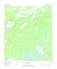
The Kuskokwim Mountains dominate the northern landscape of this mid-century Alaskan interior survey, where the terrain transitions into a complex aquatic environment. In the southern reaches, the Muddy River winds through a dense network of marshes and small lakes, illustrating the typical drainage patterns of the Alaskan wilderness before significant modern infrastructure. Topographic detail includes VABM 2546 Dean, a primary geodetic benchmark used during the 1950s mapping efforts. Based on aerial photography from 1952, the map documents a landscape defined by natural watercourses and elevation changes rather than human settlement, preserving the character of the Fourth Judicial Division during a period of extensive federal topographic surveying.
Find a feature on this map
3 named features on this map. Tap any name to fly to it.
Don’t see what you’re looking for? This feature index may not catch every label — zoom into the map to look around manually.
Map Details
Editions of this 1953 Kantishna River A-4 Map
3 editions found
Other maps of this area

1948 · Kantishna River
USGS Topo · 1:250,000

1951 · Kantishna River
USGS Topo · 1:250,000

1952 · Mount McKinley
USGS Topo · 1:250,000

1952 · Kantishna River A-3
USGS Topo · 1:63,360

1952 · Kantishna River
USGS Topo · 1:250,000

1952 · Kantishna River A-5
USGS Topo · 1:63,360

1952 · Kantishna River B-5
USGS Topo · 1:63,360

1952 · Mount McKinley D-3
USGS Topo · 1:63,360

1953 · Kantishna River B-4
USGS Topo · 1:63,360

1953 · Kantishna River B-3
USGS Topo · 1:63,360