
1953 Map of Kantishna River B-4
USGS Topo · Published 1956About this map
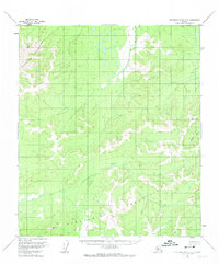
The Kuskokwim Mountains dominate this 1950s interior Alaskan landscape, providing a high-altitude study of a region defined entirely by its natural hydrology and relief. This sheet was compiled from aerial photography taken in 1952, capturing a moment when the territory remained largely devoid of permanent human infrastructure. The primary drainage of the North Fork Kuskokwim River winds through the southern portion of the quadrangle, while the Cosna River flows toward the north. The map illustrates the characteristic meandering patterns of these subarctic rivers as they cut through the dense contour lines of the mountains, a detail that remains critical for researchers studying historical geomorphology and the untouched wilderness of the Alaska-Fourth Judicial Division before modern development.
Find a feature on this map
3 named features on this map. Tap any name to fly to it.
Don’t see what you’re looking for? This feature index may not catch every label — zoom into the map to look around manually.
Map Details
Editions of this 1953 Kantishna River B-4 Map
2 editions found
Other maps of this area

1948 · Kantishna River
USGS Topo · 1:250,000

1951 · Kantishna River
USGS Topo · 1:250,000

1952 · Kantishna River A-3
USGS Topo · 1:63,360

1952 · Kantishna River C-5
USGS Topo · 1:63,360

1952 · Kantishna River
USGS Topo · 1:250,000

1952 · Kantishna River A-5
USGS Topo · 1:63,360

1952 · Kantishna River B-5
USGS Topo · 1:63,360

1952 · Kantishna River C-3
USGS Topo · 1:63,360

1952 · Kantishna River C-4
USGS Topo · 1:63,360

1953 · Kantishna River A-4
USGS Topo · 1:63,360