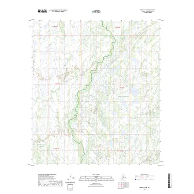
2023 Map of Denali C-4 NW
USGS Topo · Published 2023About this map
Denali National Park and the Denali National Preserve meet in this 2023 survey of the Alaska interior. The landscape is dominated by the meandering path of Birch Creek, which snakes through the central and western portions of the quadrangle across various township boundaries including t14s r23w and t13s r22w. This modern topographical study captures a protected wilderness characterized by complex hydrography and minimal human infrastructure. To the east, Corner Lake sits within the park boundaries, representing the numerous small bodies of water that dot this subarctic environment. The map illustrates the strictly defined borders of national conservation lands, providing a precise spatial record of federal land management divisions in the Denali Borough.
Find a feature on this map
10 named features on this map. Tap any name to fly to it.
Don’t see what you’re looking for? This feature index may not catch every label — zoom into the map to look around manually.
Map Details
Editions of this 2023 Denali C-4 NW Map
This is the sole edition of this map. No revisions or reprints were ever made.
Other maps of this area

1952 · Mount McKinley
USGS Topo · 1:250,000

1953 · Mount McKinley C-5
USGS Topo · 1:63,360

1953 · Mount McKinley D-5
USGS Topo · 1:63,360

1953 · Mount McKinley C-4
USGS Topo · 1:63,360

1953 · Mount McKinley D-4
USGS Topo · 1:63,360

1954 · Mount McKinley C-4
USGS Topo · 1:63,360

1954 · Mount McKinley D-4
USGS Topo · 1:63,360

1954 · Mount McKinley D-5
USGS Topo · 1:63,360

1954 · Mount McKinley C-5
USGS Topo · 1:63,360

1958 · Mount McKinley
USGS Topo · 1:250,000