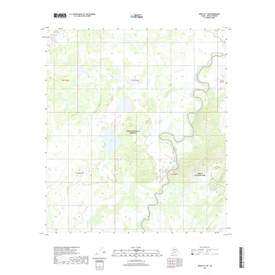
2017 Map of Denali D-4 SW
USGS Topo · Published 2017About this map
Denali National Park and the Denali National Preserve meet in this interior Alaskan landscape, where the topography transitions from low-lying wetlands to defined ridge lines. The map documentation reveals a complex hydrological network dominated by the winding course of Birch Creek and the stagnant waters of Hot Slough. Centrally located, Carlson Lake sits within a mosaic of smaller unnamed ponds and marshy terrain, characteristic of the region north of the Alaska Range. This area, largely defined by its natural features rather than human infrastructure, shows the subtle drainage patterns of Spence Cr as it feeds into the broader basin. The absence of roads or permanent settlements highlights the protected status and primitive nature of this section of the Denali wilderness during the early 21st century.
Find a feature on this map
11 named features on this map. Tap any name to fly to it.
Don’t see what you’re looking for? This feature index may not catch every label — zoom into the map to look around manually.
Map Details
Editions of this 2017 Denali D-4 SW Map
This is the sole edition of this map. No revisions or reprints were ever made.
Other maps of this area

1952 · Mount McKinley
USGS Topo · 1:250,000

1953 · Mount McKinley C-5
USGS Topo · 1:63,360

1953 · Mount McKinley D-5
USGS Topo · 1:63,360

1953 · Mount McKinley C-4
USGS Topo · 1:63,360

1953 · Mount McKinley D-4
USGS Topo · 1:63,360

1954 · Mount McKinley C-4
USGS Topo · 1:63,360

1954 · Mount McKinley D-4
USGS Topo · 1:63,360

1954 · Mount McKinley D-5
USGS Topo · 1:63,360

1954 · Mount McKinley C-5
USGS Topo · 1:63,360

1958 · Mount McKinley
USGS Topo · 1:250,000