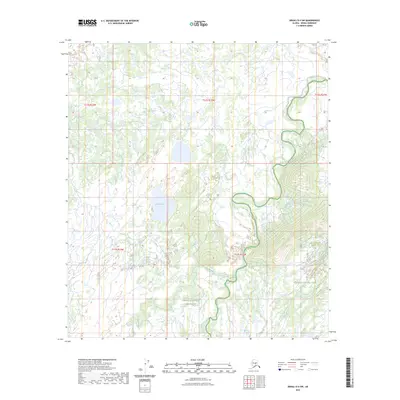
2023 Map of Denali D-4 SW
USGS Topo · Published 2023About this map
Denali National Preserve and the adjoining Denali National Park anchor this sub-arctic terrain, where the landscape is defined by the winding hydrology of the interior. The expansive wetlands and river systems are dominated by Birch Creek, which carves a deep meandering path across the eastern quadrant. Further west, Carlson Lake sits as a significant inland water body, surrounded by a complex network of seasonal drainages. The map details the transition from the low-lying Hot Slough to the more distinct riparian corridors of Spence Creek. This 2023 survey provides a clear view of the protected wilderness boundaries and the natural water-driven geography that shapes this part of the Denali Borough.
Find a feature on this map
11 named features on this map. Tap any name to fly to it.
Don’t see what you’re looking for? This feature index may not catch every label — zoom into the map to look around manually.
Map Details
Editions of this 2023 Denali D-4 SW Map
This is the sole edition of this map. No revisions or reprints were ever made.
Other maps of this area

1952 · Mount McKinley
USGS Topo · 1:250,000

1953 · Mount McKinley C-5
USGS Topo · 1:63,360

1953 · Mount McKinley D-5
USGS Topo · 1:63,360

1953 · Mount McKinley C-4
USGS Topo · 1:63,360

1953 · Mount McKinley D-4
USGS Topo · 1:63,360

1954 · Mount McKinley C-4
USGS Topo · 1:63,360

1954 · Mount McKinley D-4
USGS Topo · 1:63,360

1954 · Mount McKinley D-5
USGS Topo · 1:63,360

1954 · Mount McKinley C-5
USGS Topo · 1:63,360

1958 · Mount McKinley
USGS Topo · 1:250,000