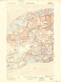
1943 Map of Dennis
USGS Topo · Published 1950About this map
Scargo Hill and the adjacent Firetower overlook a landscape defined by the shifting interface of freshwater ponds and saltwater inlets on Cape Cod. During the mid-twentieth century, the region maintained a mix of established coastal villages and developing transit corridors. The New York New Haven and Hartford railroad cuts through the center of the map, serving as a primary artery between Yarmouth and South Dennis, with a stop at Bass River Sta.
Find a feature on this map
103 named features on this map. Tap any name to fly to it.
Don’t see what you’re looking for? This feature index may not catch every label — zoom into the map to look around manually.
Map Details
Editions of this 1943 Dennis Map
3 editions found
Other maps of this area

1887 · Wellfleet
USGS Topo · 1:62,500

1887 · Yarmouth
USGS Topo · 1:62,500

1888 · Barnstable
USGS Topo · 1:62,500

1889 · Yarmouth
USGS Topo · 1:62,500

1889 · Wellfleet
USGS Topo · 1:62,500

1893 · Yarmouth
USGS Topo · 1:62,500

1893 · Wellfleet
USGS Topo · 1:62,500

1893 · Barnstable
USGS Topo · 1:62,500

1942 · Cape Cod Bay
USGS Topo · 1:125,000
1942 · Hyannis
USGS Topo · 1:31,680