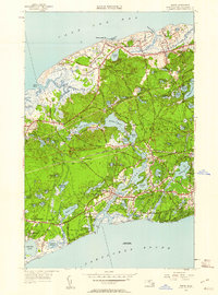
1949 Map of Dennis
USGS Topo · Published 1960About this map
The mid-century coastal landscape of central Cape Cod is defined here by the winding Bass River and its connection to both Cape Cod Bay and Nantucket Sound. Small village centers like South Yarmouth and West Dennis are joined by a network of local roads such as Old Chatham Road and Trotting Park Road, reflecting the region's historic transition from seafaring to seasonal tourism. Along the northern shore, maritime activity is anchored by Sesuit Harbor and Nobscusset Harbor, while the interior is punctuated by numerous kettle ponds including Follins Pond and the prominent Scargo Lake. Significant landmarks for genealogists and local historians include Howes Cem and W Yarmouth Cem, alongside the Bass River Sta which served the rail corridor. Elevated points like Black Bell Hill and the curiosity of Hokum Rock rise above the dense woodland and salt marshes of Chase Garden Creek.
Find a feature on this map
91 named features on this map. Tap any name to fly to it.
Don’t see what you’re looking for? This feature index may not catch every label — zoom into the map to look around manually.
Map Details
Editions of this 1949 Dennis Map
2 editions found
Other maps of this area

1887 · Wellfleet
USGS Topo · 1:62,500

1887 · Yarmouth
USGS Topo · 1:62,500

1888 · Barnstable
USGS Topo · 1:62,500

1889 · Yarmouth
USGS Topo · 1:62,500

1889 · Wellfleet
USGS Topo · 1:62,500

1893 · Yarmouth
USGS Topo · 1:62,500

1893 · Wellfleet
USGS Topo · 1:62,500

1893 · Barnstable
USGS Topo · 1:62,500

1942 · Cape Cod Bay
USGS Topo · 1:125,000
1942 · Hyannis
USGS Topo · 1:31,680