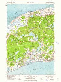
1961 Map of Dennis
USGS Topo · Published 1963About this map
Bass River snakes between the towns of Yarmouth and Dennis, serving as a central artery for a landscape defined by its transition from harbor villages to wooded interior ponds. This 1961 revision captures the mid-century development of the Cape, where the Mid-Cape Highway and New York New Haven and Hartford railroad corridor intersect a much older network of cart paths and family-named landmarks like Black Ball Hill and German Hill. From the north shore at Sesuit Harbor to the southern coast at Dennis Port, the map is densely populated with genealogical touchstones, including the Quaker Cem, Paddock Cem, and Homer Cem. Extensive Sand and Gravel Pits dot the interior, illustrating the industrial activity supporting the era's regional growth near the Yarmouth-Dennis Regional High Sch.
Find a feature on this map
95 named features on this map. Tap any name to fly to it.
Don’t see what you’re looking for? This feature index may not catch every label — zoom into the map to look around manually.
Map Details
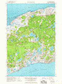
Editions of this 1961 Dennis Map
2 editions found
Other maps of this area

1887 · Wellfleet
USGS Topo · 1:62,500

1887 · Yarmouth
USGS Topo · 1:62,500

1888 · Barnstable
USGS Topo · 1:62,500

1889 · Yarmouth
USGS Topo · 1:62,500

1889 · Wellfleet
USGS Topo · 1:62,500

1893 · Yarmouth
USGS Topo · 1:62,500

1893 · Wellfleet
USGS Topo · 1:62,500

1893 · Barnstable
USGS Topo · 1:62,500

1942 · Cape Cod Bay
USGS Topo · 1:125,000
1942 · Hyannis
USGS Topo · 1:31,680