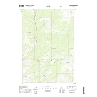
2020 Map of Dennis Mountain
USGS Topo · Published 2020About this map
Nez Perce National Forest and Bitterroot National Forest meet in this high-altitude section of Idaho County, defined by a series of prominent peaks and drainage systems. The landscape is dominated by massive landforms such as Mount Harrington, Dennis Mtn, and the long sweep of Harrington Ridge. These summits are linked by high-elevation passes including Buck Creek Saddle and Harrington Saddle, which likely dictated movement through this backcountry.
Find a feature on this map
39 named features on this map. Tap any name to fly to it.
Don’t see what you’re looking for? This feature index may not catch every label — zoom into the map to look around manually.
Map Details
Editions of this 2020 Dennis Mountain Map
This is the sole edition of this map. No revisions or reprints were ever made.
Other maps of this area

1956 · Elk City
USGS Topo · 1:250,000

1960 · Elk City
USGS Topo · 1:250,000

1978 · Waugh Mountain
USGS Topo · 1:24,000

1978 · Arctic Point
USGS Topo · 1:24,000

1978 · Spread Creek Point
USGS Topo · 1:24,000

1978 · Dennis Mtn
USGS Topo · 1:24,000

1978 · Magruder Mtn
USGS Topo · 1:24,000

1978 · Sheep Hill
USGS Topo · 1:24,000

1978 · Devils Teeth Rapids
USGS Topo · 1:24,000
1979 · Sabe Mtn
USGS Topo · 1:24,000