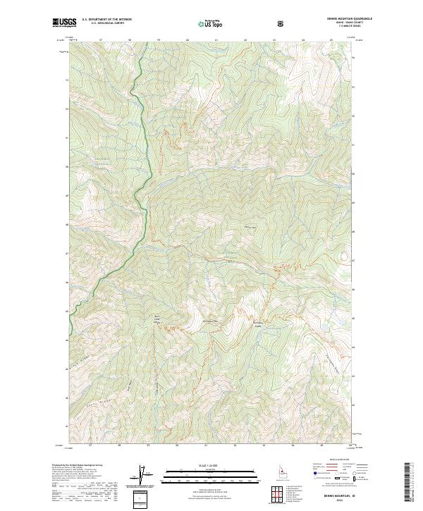
2024 Map of Dennis Mountain
USGS Topo · Published 2024About this map
Nez Perce National Forest and the Frank Church-River of No Return Wilderness converge in this high-altitude drainage of the Salmon River mountains. The landscape is defined by its extensive trail network and watershed system, where Sabe Creek flows south past Sabe Creek Trl, carving a deep valley between Smith Ridge and the central peaks. High points like Dennis Mtn and Harrington Mtn serve as anchor points for several routes, including the Mount Harrington Trl and Dennis Creek Trl. Smaller features like Cabin Spring near Harrington Saddle suggest the vital role of water sources for those navigating these remote interior ridges. The presence of the Bitterroot National Forest on the eastern edge highlights the complex administrative boundaries governing these protected lands.
Find a feature on this map
38 named features on this map. Tap any name to fly to it.
Don’t see what you’re looking for? This feature index may not catch every label — zoom into the map to look around manually.
Map Details
Editions of this 2024 Dennis Mountain Map
This is the sole edition of this map. No revisions or reprints were ever made.
Other maps of this area

1956 · Elk City
USGS Topo · 1:250,000

1960 · Elk City
USGS Topo · 1:250,000

1978 · Waugh Mountain
USGS Topo · 1:24,000

1978 · Arctic Point
USGS Topo · 1:24,000

1978 · Spread Creek Point
USGS Topo · 1:24,000

1978 · Dennis Mtn
USGS Topo · 1:24,000

1978 · Magruder Mtn
USGS Topo · 1:24,000

1978 · Sheep Hill
USGS Topo · 1:24,000

1978 · Devils Teeth Rapids
USGS Topo · 1:24,000
1979 · Sabe Mtn
USGS Topo · 1:24,000