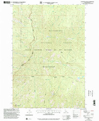
1998 Map of Dennis Mountain
USGS Topo · Published 2002About this map
The Frank Church River of No Return Wilderness dominates this 1990s terrain, marking a vast protected landscape where the Nez Perce National Forest and Bitterroot National Forest meet. The map reveals a complex network of high-elevation drainages and prominent peaks, including Dennis Mountain and Harrington Mountain. A notable transition occurs along the Salmon Wild and Scenic River, where the steep topography of Dennis Ridge and Black Ridge falls toward the river corridor. Evidence of backcountry navigation is sparse but specific, with the Campsite near Saddle Creek and established crossings like Black Creek Saddle and Harrington Saddle providing essential orientation points for those tracing the historical trails and ranger district boundaries of central Idaho.
Find a feature on this map
41 named features on this map. Tap any name to fly to it.
Don’t see what you’re looking for? This feature index may not catch every label — zoom into the map to look around manually.
Map Details
Editions of this 1998 Dennis Mountain Map
This is the sole edition of this map. No revisions or reprints were ever made.
Other maps of this area

1956 · Elk City
USGS Topo · 1:250,000

1960 · Elk City
USGS Topo · 1:250,000

1978 · Waugh Mountain
USGS Topo · 1:24,000

1978 · Arctic Point
USGS Topo · 1:24,000

1978 · Spread Creek Point
USGS Topo · 1:24,000

1978 · Dennis Mtn
USGS Topo · 1:24,000

1978 · Magruder Mtn
USGS Topo · 1:24,000

1978 · Sheep Hill
USGS Topo · 1:24,000

1978 · Devils Teeth Rapids
USGS Topo · 1:24,000
1979 · Sabe Mtn
USGS Topo · 1:24,000