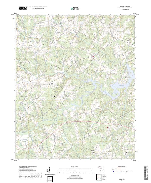
2024 Map of Denny
USGS Topo · Published 2024About this map
Denny and Mount Willing anchor this rural landscape in Saluda County, where the terrain is defined by the winding course of the Little Saluda River and its many tributaries. The area is marked by a high density of family-named burial grounds and local landmarks, including the Riley Smith Cem, Mitchell Hill Cem, and Butler Church Graveyard. These sites, along with names like Lenora Mitchell Rd and Andrew Coleman Rd, point to deep-rooted community ties across the countryside. To the east, the shoreline of Lake Murray reaches into the hills, fed by Indian Creek and Big Creek. The road network reflects a long history of overland travel between farmsteads, with routes such as Old Cherokee Trl and Hollywood Rd crossing the undulating landscape. Small waterways like Burnets Creek and Canebrake Branch further divide the territory, illustrating the hydrological drainage patterns that have shaped local settlement and agriculture for generations.
Find a feature on this map
102 named features on this map. Tap any name to fly to it.
Don’t see what you’re looking for? This feature index may not catch every label — zoom into the map to look around manually.
Map Details
Editions of this 2024 Denny Map
This is the sole edition of this map. No revisions or reprints were ever made.
Other maps of this area

1941 · Spartanburg
USGS Topo · 1:250,000

1953 · Spartanburg
USGS Topo · 1:250,000

1954 · Augusta
USGS Topo · 1:250,000

1957 · Augusta
USGS Topo · 1:250,000

1958 · Augusta
USGS Topo · 1:250,000

1960 · Spartanburg
USGS Topo · 1:250,000

1961 · Augusta
USGS Topo · 1:250,000

1962 · Augusta
USGS Topo · 1:250,000

1963 · Spartanburg
USGS Topo · 1:250,000

1964 · Spartanburg
USGS Topo · 1:250,000