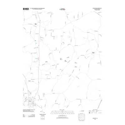
2013 Map of Denton
USGS Topo · Published 2013About this map
Denton anchors the southern portion of this landscape, where a structured grid of streets like S Main St and Cox Ave reflects the town's role as a regional hub. Moving northward, the terrain becomes increasingly defined by a series of prominent summits including Prickly Pear Mountain, Steep Rock Mountain, and Crouse Mountain. This area is characterized by scattered settlements such as Cid, Snyder, and Silver Valley, connected by a network of rural roads that navigate the complex drainage systems of Lick Cr and Toms Cr. The geography here illustrates a classic Piedmont transition, where early industrial remnants like Valley Mine Rd hint at the area's mineral history, while modern landmarks such as the Carter Lumber Plant Rd signify evolving land use in the 21st century.
Find a feature on this map
140 named features on this map. Tap any name to fly to it.
Don’t see what you’re looking for? This feature index may not catch every label — zoom into the map to look around manually.
Map Details
Editions of this 2013 Denton Map
This is the sole edition of this map. No revisions or reprints were ever made.
Other maps of this area

1949 · High Rock
USGS Topo · 1:24,000

1949 · Denton NW
USGS Topo · 1:24,000

1950 · Lexington East
USGS Topo · 1:24,000

1951 · Lexington East
USGS Topo · 1:24,000

1951 · Fair Grove
USGS Topo · 1:24,000

1953 · Raleigh
USGS Topo · 1:250,000

1953 · Charlotte
USGS Topo · 1:250,000

1954 · Charlotte
USGS Topo · 1:250,000

1954 · Raleigh
USGS Topo · 1:250,000

1957 · Denton
USGS Topo · 1:62,500