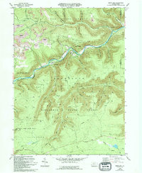
1969 Map of Dents Run
USGS Topo · Published 1994About this map
The Bennett Branch Sinnemahoning Creek valley serves as the primary artery for settlement and industry in this 1960s landscape. Small communities like Dents Run and Summerson follow the watercourse, while the surrounding uplands are defined by the transition from heavy resource extraction to conservation. Evidence of the coal industry is visible in the numerous Strip Mines and Reclaimed Strip Mines on Winslow Hill, while the proliferation of a Gas Well network throughout Elk State Forest and Moshannon State Forest indicates the shift toward natural gas production. Genealogists will find the Johnson Cem and another Cem near the creek, alongside family-named landmarks like McPherson Hollow and Grant Hill. For outdoor historians, the primitive path of the Quehanna Trail winds through the southern half of the quadrangle.
Find a feature on this map
49 named features on this map. Tap any name to fly to it.
Don’t see what you’re looking for? This feature index may not catch every label — zoom into the map to look around manually.
Map Details
Editions of this 1969 Dents Run Map
3 editions found
Other maps of this area

1929 · Karthaus
USGS Topo · 1:62,500

1929 · Clearfield
USGS Topo · 1:48,000

1932 · Clearfield
USGS Topo · 1:62,500

1932 · Karthaus
USGS Topo · 1:62,500

1941 · Benezette
USGS Topo · 1:62,500

1943 · Benezette
USGS Topo · 1:62,500

1945 · Driftwood
USGS Topo · 1:48,000

1945 · Driftwood
USGS Topo · 1:24,000

1945 · Cameron
USGS Topo · 1:24,000

1947 · Cameron
USGS Topo · 1:24,000
Featured Places
- Benezette Township, PA
- Gibson Township, PA
- Grant, Benezette Township
- Wilmer, Benezette Township
- Sumerson, Benezette Township