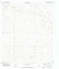
1971 Map of Denver City SE
USGS Topo · Published 1974About this map
West Seminole Oil Field dominates this West Texas landscape, revealing the industrial footprint of the Permian Basin in the early 1970s. The terrain is defined by a dense network of extraction infrastructure, where dozens of Oil Wells and a Gasoline Plant sit among the arid plains of Gaines County. The ephemeral drainage of Wardswell Draw meanders across the upper half of the sheet, providing the only major topographic relief in an area otherwise marked by the straight lines of pipelines and fence boundaries.
Find a feature on this map
10 named features on this map. Tap any name to fly to it.
Don’t see what you’re looking for? This feature index may not catch every label — zoom into the map to look around manually.
Map Details
Editions of this 1971 Denver City SE Map
This is the sole edition of this map. No revisions or reprints were ever made.
Other maps of this area

1954 · Hobbs
USGS Topo · 1:250,000

1958 · Hobbs
USGS Topo · 1:250,000

1970 · Seagraves SW
USGS Topo · 1:24,000

1970 · Seagraves NW
USGS Topo · 1:24,000

1970 · Seminole
USGS Topo · 1:24,000

1971 · Paynes Corner
USGS Topo · 1:24,000

1971 · Higginbotham
USGS Topo · 1:24,000
1971 · Denver City
USGS Topo · 1:24,000

1971 · Denver City SW
USGS Topo · 1:24,000
1971 · Paynes Corner NW
USGS Topo · 1:24,000