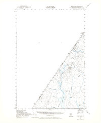
1955 Map of Depot Lake
USGS Topo · Published 1965About this map
The international boundary between Quebec and Maine defines the western edge of this 1955 survey, highlighting a remote section of the North Maine Woods. At the heart of this topographic study lies Depot Lake, fed by Depot Stream and surrounded by a network of drainage basins including Glazier Brook, Brown Brook, and Cedar Brook. The landscape is dominated by the prominence of Depot Mtn, which features a Lookout Tower for fire observation.
Find a feature on this map
25 named features on this map. Tap any name to fly to it.
Don’t see what you’re looking for? This feature index may not catch every label — zoom into the map to look around manually.
Map Details
Editions of this 1955 Depot Lake Map
2 editions found
Other maps of this area

1954 · Presque Isle
USGS Topo · 1:250,000

1955 · Little East Lake
USGS Topo · 1:62,500

1955 · Depot Lake
USGS Topo · 1:62,500

1955 · Beaver Pond
USGS Topo · 1:62,500

1955 · Clayton Lake
USGS Topo · 1:62,500

1955 · Seven Islands
USGS Topo · 1:62,500

1958 · Presque Isle
USGS Topo · 1:250,000

1960 · Presque Isle
USGS Topo · 1:250,000

1962 · Edmundston
USGS Topo · 1:250,000

1962 · Quebec
USGS Topo · 1:250,000