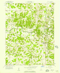
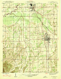
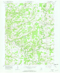
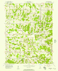
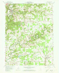
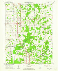
1956 Map of Deputy
USGS Topo · Published 1957About this map
Deputy and Commiskey sit as primary hubs along the Baltimore and Ohio railroad corridor in this mid-century survey of southern Indiana. The landscape is defined by the winding course of the East Fork Muscatatuck River, which serves as a natural boundary for several townships including Marion, Montgomery, and Johnson. The map documents a rural community supported by a dense network of country churches and family burial grounds, such as Mt Gilead Ch and Robertson Cem, which are scattered among the ridges and creek valleys. Notable crossings and small settlements like Paris Crossing and Hilltown indicate the importance of early transportation routes. Near the river, a Gaging Station and the Wigham Cem highlight the intersection of local industry and pioneer history in this corner of Jefferson and Jennings Counties.
Find a feature on this map
36 named features on this map. Tap any name to fly to it.
Don’t see what you’re looking for? This feature index may not catch every label — zoom into the map to look around manually.
Map Details
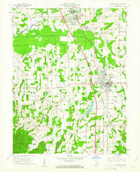
Editions of this 1956 Deputy Map
This is the sole edition of this map. No revisions or reprints were ever made.
Other maps of this area
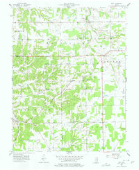
1947 · Scottsburg
USGS Topo · 1:24,000
1956 · Volga
USGS Topo · 1:24,000
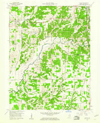
1956 · Blocher
USGS Topo · 1:24,000
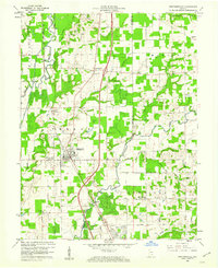
1956 · Kent
USGS Topo · 1:24,000

1956 · Louisville
USGS Topo · 1:250,000
1959 · Vernon
USGS Topo · 1:24,000
1959 · Hayden
USGS Topo · 1:24,000
1959 · Crothersville
USGS Topo · 1:24,000
1959 · Chestnut Ridge
USGS Topo · 1:24,000
1960 · Scottsburg
USGS Topo · 1:24,000