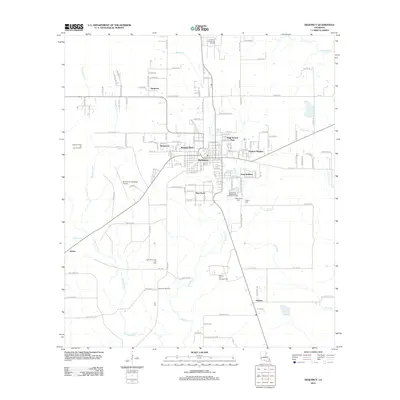
2012 Map of DeQuincy
USGS Topo · Published 2012About this map
DeQuincy stands at the heart of this Calcasieu Parish landscape, surrounded by residential developments like Westwood, Western Pines, and Eastern Heights. The town's layout is defined by its industrial and civic infrastructure, including the De Quincy Industrial Airpark and the Louisiana Correctional Institute to the north. The surrounding countryside is deeply marked by the energy industry, with the Cowards Gully Oil and Gas Field, North De Quincy Oil Field, and Perkins Oil and Gas Field dotting the terrain.
Find a feature on this map
146 named features on this map. Tap any name to fly to it.
Don’t see what you’re looking for? This feature index may not catch every label — zoom into the map to look around manually.
Map Details
Editions of this 2012 DeQuincy Map
This is the sole edition of this map. No revisions or reprints were ever made.
Other maps of this area

1935 · Buhler
USGS Topo · 1:31,680

1935 · Gordon
USGS Topo · 1:31,680

1947 · DeQuincy
USGS Topo · 1:31,680

1947 · Sulphur Mines
USGS Topo · 1:31,680

1947 · Oretta
USGS Topo · 1:31,680

1947 · Kernan
USGS Topo · 1:31,680

1947 · Hyatt
USGS Topo · 1:31,680

1947 · Lunita
USGS Topo · 1:31,680

1947 · Long Marsh
USGS Topo · 1:31,680

1949 · Kernan
USGS Topo · 1:31,680