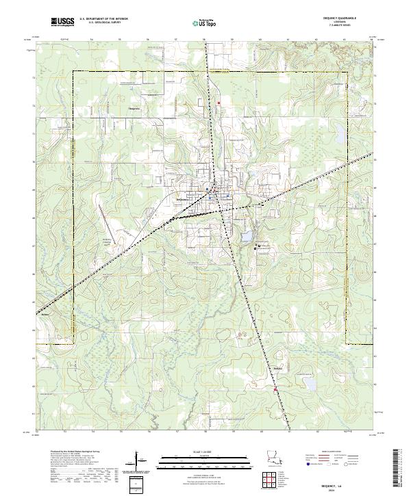
2024 Map of DeQuincy
USGS Topo · Published 2024About this map
DeQuincy stands at the heart of this contemporary landscape, situated where the jurisdictional lines of Beauregard Parish and Calcasieu Parish meet. This region is defined by a dense network of drainage systems, including Buxton Creek, Beckwith Creek, and numerous named gullies like Beefpen Gully and Cowards Gully that feed toward the Little River in the south. The settlement pattern reflects both established residential areas and industrial growth, anchored by the De Quincy Industrial Airpark to the west of the main town center.
Find a feature on this map
122 named features on this map. Tap any name to fly to it.
Don’t see what you’re looking for? This feature index may not catch every label — zoom into the map to look around manually.
Map Details
Editions of this 2024 DeQuincy Map
This is the sole edition of this map. No revisions or reprints were ever made.
Other maps of this area

1935 · Buhler
USGS Topo · 1:31,680

1935 · Gordon
USGS Topo · 1:31,680

1947 · DeQuincy
USGS Topo · 1:31,680

1947 · Sulphur Mines
USGS Topo · 1:31,680

1947 · Oretta
USGS Topo · 1:31,680

1947 · Kernan
USGS Topo · 1:31,680

1947 · Hyatt
USGS Topo · 1:31,680

1947 · Lunita
USGS Topo · 1:31,680

1947 · Long Marsh
USGS Topo · 1:31,680

1949 · Kernan
USGS Topo · 1:31,680