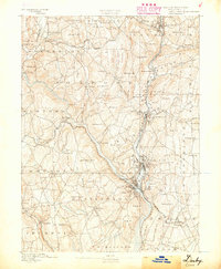
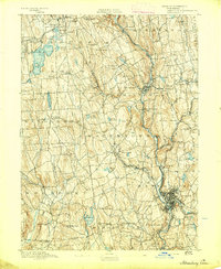
1889 Map of Derby
USGS Topo · Published 1889About this map
Industrial nodes converge at the junction of the Housatonic River and the Naugatuck River during this late nineteenth-century survey. The landscape is defined by its deep river valleys and the dense rail infrastructure that fueled the region's manufacturing growth, including the Naugatuck Division New York New Haven And Hartford Railroad. Significant commercial centers like Birmingham, Derby, and Ansonia appear as tightly packed settlements, while the surrounding uplands remain dotted with family-named landmarks such as John Johnson Hill and Georges Cellar Hill.
Find a feature on this map
108 named features on this map. Tap any name to fly to it.
Don’t see what you’re looking for? This feature index may not catch every label — zoom into the map to look around manually.
Map Details
Editions of this 1889 Derby Map
This is the sole edition of this map. No revisions or reprints were ever made.
Other maps of this area
1891 · Bridgeport
USGS Topo · 1:62,500
1891 · Derby
USGS Topo · 1:62,500

1892 · New Haven
USGS Topo · 1:62,500
1892 · Danbury
USGS Topo · 1:62,500
1892 · New Milford
USGS Topo · 1:62,500
1892 · Norwalk
USGS Topo · 1:62,500

1892 · Meriden
USGS Topo · 1:62,500
1893 · Bridgeport
USGS Topo · 1:62,500
1893 · Norwalk
USGS Topo · 1:62,500
1893 · Waterbury
USGS Topo · 1:62,500