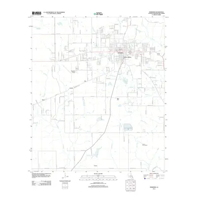
2012 Map of DeRidder
USGS Topo · Published 2012About this map
DeRidder serves as the primary urban center for this portion of Beauregard Parish, showing a dense street grid that transitions into the outlying Hudson Addition. The southern reach of the city is anchored by the Beauregard Regional Airport, while smaller aviation history is preserved at the uniquely named Swamp Smith Airport to the southeast. Outside the city limits, the landscape is defined by the winding paths of Palmetto Creek and Hickory Branch, with scattered rural clusters at Hite, Grabow, and Shear. Further south, the map identifies the locations of Bon Ami and Carson, settlements that hint at the region's historic dependence on the timber industry. Genealogists may find the location of Woodlawn Cemetery particularly useful for tracing local family histories within the DeRidder area.
Find a feature on this map
181 named features on this map. Tap any name to fly to it.
Don’t see what you’re looking for? This feature index may not catch every label — zoom into the map to look around manually.
Map Details
Editions of this 2012 DeRidder Map
This is the sole edition of this map. No revisions or reprints were ever made.
Other maps of this area

1947 · Singer
USGS Topo · 1:31,680

1947 · Pujo
USGS Topo · 1:31,680

1947 · DeRidder
USGS Topo · 1:31,680

1947 · Rosepine
USGS Topo · 1:31,680

1947 · Knight
USGS Topo · 1:31,680

1947 · Ikes
USGS Topo · 1:31,680

1947 · Chasmore
USGS Topo · 1:31,680

1947 · Beckwith School
USGS Topo · 1:31,680

1947 · Bannister
USGS Topo · 1:31,680

1952 · Lake Charles
USGS Topo · 1:250,000