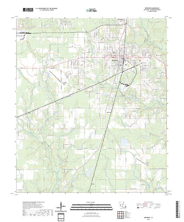
2024 Map of DeRidder
USGS Topo · Published 2024About this map
DeRidder serves as the central hub of this modern Louisiana landscape, anchored by the Beauregard Parish Courthouse and a dense network of residential streets. The surrounding area preserves the names of several small communities including Ludington to the north, Bon Ami and Hite to the south, and the outlying settlements of Shear and Carson. These names often trace back to the region's historic timber industry and the mill towns that once defined the local economy along the rail lines.
Find a feature on this map
88 named features on this map. Tap any name to fly to it.
Don’t see what you’re looking for? This feature index may not catch every label — zoom into the map to look around manually.
Map Details
Editions of this 2024 DeRidder Map
This is the sole edition of this map. No revisions or reprints were ever made.
Other maps of this area

1947 · Singer
USGS Topo · 1:31,680

1947 · Pujo
USGS Topo · 1:31,680

1947 · DeRidder
USGS Topo · 1:31,680

1947 · Rosepine
USGS Topo · 1:31,680

1947 · Knight
USGS Topo · 1:31,680

1947 · Ikes
USGS Topo · 1:31,680

1947 · Chasmore
USGS Topo · 1:31,680

1947 · Beckwith School
USGS Topo · 1:31,680

1947 · Bannister
USGS Topo · 1:31,680

1952 · Lake Charles
USGS Topo · 1:250,000