
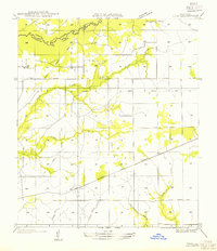
1947 Map of DeRidder
USGS Topo · Published 1947About this map
The timber and transit hub of De Ridder serves as the focal point for this survey of Beauregard Parish, where a dense network of competing rail lines converges. The Kansas City Southern and Southern Pacific corridors dominate the landscape, supporting established timber-related settlements like Ludington, Grabow, and Carson. The layout of the region is deeply tied to the lumber industry's peak, evidenced by the numerous stretches of Old Logging Railroad Grade that branch into the surrounding piney woods near Hickory Branch and Cowpen Creek.
Find a feature on this map
23 named features on this map. Tap any name to fly to it.
Don’t see what you’re looking for? This feature index may not catch every label — zoom into the map to look around manually.
Map Details
Editions of this 1947 DeRidder Map
This is the sole edition of this map. No revisions or reprints were ever made.
Other maps of this area

1947 · Singer
USGS Topo · 1:31,680

1947 · Pujo
USGS Topo · 1:31,680

1947 · Rosepine
USGS Topo · 1:31,680

1947 · Knight
USGS Topo · 1:31,680

1947 · Ikes
USGS Topo · 1:31,680

1947 · Chasmore
USGS Topo · 1:31,680

1947 · Beckwith School
USGS Topo · 1:31,680

1947 · Bannister
USGS Topo · 1:31,680

1952 · Lake Charles
USGS Topo · 1:250,000
1954 · Pujo
USGS Topo · 1:31,680