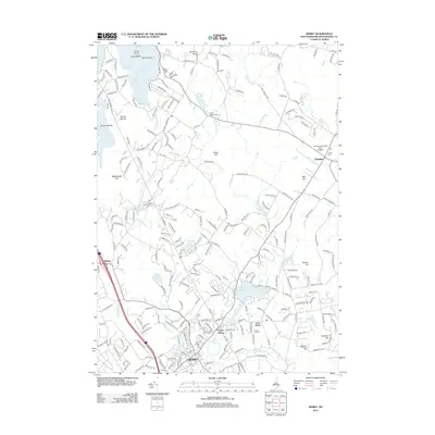
2012 Map of Derry
USGS Topo · Published 2012About this map
Derry and Derry Village anchor the southern landscape of this 2012 survey, showing the dense network of local roads that connect these historic Rockingham County hubs. To the northeast, the town of Chester sits along the Exeter River, near the Chester College of New England and the Village Cem. The terrain is defined by a series of prominent rises including Silver Hill, Rattlesnake Hill, and Mine Hill, the latter of which features the Devils Den Lookout Tower overlooking the eastern reaches of Massabesic Lake.
Find a feature on this map
230 named features on this map. Tap any name to fly to it.
Don’t see what you’re looking for? This feature index may not catch every label — zoom into the map to look around manually.
Map Details
Editions of this 2012 Derry Map
This is the sole edition of this map. No revisions or reprints were ever made.
Other maps of this area

1888 · Haverhill
USGS Topo · 1:62,500

1890 · Haverhill
USGS Topo · 1:62,500

1893 · Haverhill
USGS Topo · 1:62,500

1905 · Manchester
USGS Topo · 1:62,500

1917 · Mt. Pawtuckaway
USGS Topo · 1:62,500

1919 · Mt. Pawtuckaway
USGS Topo · 1:62,500

1921 · Suncook
USGS Topo · 1:62,500

1935 · Haverhill
USGS Topo · 1:62,500

1939 · Mt. Pawtuckaway
USGS Topo · 1:62,500

1941 · Manchester
USGS Topo · 1:62,500