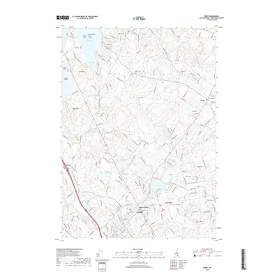
2018 Map of Derry
USGS Topo · Published 2018About this map
Derry and its surrounding hamlets show a landscape shaped by glacial deposits and colonial settlement patterns. The concentration of historical burial grounds, including Forest Hill Cem near East Derry and Long Meadow Cem to the north, indicates the deep roots of these Rockingham County communities. The terrain is characterized by a series of drumlin-like rises such as Bunker Hill and Mine Hill, which overlook a network of water bodies like Beaver Lake and the expansive Massabesic Lake. The settlement at Wilson and the cluster of homes at Derry Village reflect the 21st-century residential density filling the spaces between traditional New Hampshire village centers. Small-scale water features like Shields Pond and Rainbow Lake dot the landscape, intertwined with a dense grid of modern roads and older thoroughfares like the Chester Tpke.
Find a feature on this map
204 named features on this map. Tap any name to fly to it.
Don’t see what you’re looking for? This feature index may not catch every label — zoom into the map to look around manually.
Map Details
Editions of this 2018 Derry Map
This is the sole edition of this map. No revisions or reprints were ever made.
Other maps of this area

1888 · Haverhill
USGS Topo · 1:62,500

1890 · Haverhill
USGS Topo · 1:62,500

1893 · Haverhill
USGS Topo · 1:62,500

1905 · Manchester
USGS Topo · 1:62,500

1917 · Mt. Pawtuckaway
USGS Topo · 1:62,500

1919 · Mt. Pawtuckaway
USGS Topo · 1:62,500

1921 · Suncook
USGS Topo · 1:62,500

1935 · Haverhill
USGS Topo · 1:62,500

1939 · Mt. Pawtuckaway
USGS Topo · 1:62,500

1941 · Manchester
USGS Topo · 1:62,500