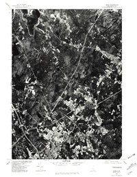
1977 Map of Derry
USGS Topo · Published 1981About this map
Derry and the neighboring settlement of Chester are captured during a period of transition in the late 1970s, as traditional New Hampshire village centers began to integrate with modern transportation corridors. The orthophoto format provides a clear view of the dense development around Derry Village contrasted with the more distributed agricultural and forested tracts to the north. Significant water bodies, most notably Massabesic Lake in the northwest and the centrally located Beaver Lake, anchor the landscape. The emergence of major infrastructure is visible through the path of Interstate 93, which intersects the western edge of the quadrangle. Topographic features like Mine Hill break the residential expansion, offering a look at the natural constraints on development in Rockingham County at this time. This 1977 aerial perspective preserves the exact footprint of local roads like Route 102 and Route 121 before decades of subsequent suburban growth.
Find a feature on this map
10 named features on this map. Tap any name to fly to it.
Don’t see what you’re looking for? This feature index may not catch every label — zoom into the map to look around manually.
Map Details
Editions of this 1977 Derry Map
This is the sole edition of this map. No revisions or reprints were ever made.
Other maps of this area

1888 · Haverhill
USGS Topo · 1:62,500

1890 · Haverhill
USGS Topo · 1:62,500

1893 · Haverhill
USGS Topo · 1:62,500

1905 · Manchester
USGS Topo · 1:62,500

1917 · Mt. Pawtuckaway
USGS Topo · 1:62,500

1919 · Mt. Pawtuckaway
USGS Topo · 1:62,500

1921 · Suncook
USGS Topo · 1:62,500

1935 · Haverhill
USGS Topo · 1:62,500

1939 · Mt. Pawtuckaway
USGS Topo · 1:62,500

1941 · Manchester
USGS Topo · 1:62,500