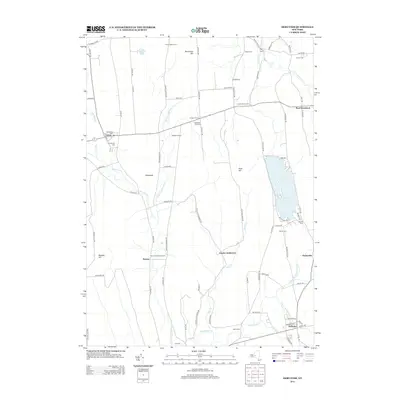
2013 Map of DeRuyter
USGS Topo · Published 2013About this map
DeRuyter Reservoir dominates the eastern landscape of this Central New York region, situated at the intersection of Onondaga, Madison, and Cortland counties. The map captures a transition from the village centers of Fabius and DeRuyter to more isolated upland settlements and family-named agricultural plots. Genealogists will find a high density of burial grounds throughout the terrain, including Old Fabius Cem, Keeney Settlement Cem, and Stockham Hill Cem, reflecting the early pioneer settlement patterns along the highland ridges.
Find a feature on this map
93 named features on this map. Tap any name to fly to it.
Don’t see what you’re looking for? This feature index may not catch every label — zoom into the map to look around manually.
Map Details
Editions of this 2013 DeRuyter Map
This is the sole edition of this map. No revisions or reprints were ever made.
Other maps of this area

1897 · Cazenovia
USGS Topo · 1:62,500

1899 · Cazenovia
USGS Topo · 1:62,500

1900 · Tully
USGS Topo · 1:62,500

1903 · Cortland
USGS Topo · 1:62,500

1904 · Pitcher
USGS Topo · 1:62,500

1942 · Oran
USGS Topo · 1:24,000

1943 · Jamesville
USGS Topo · 1:31,680
1943 · Oran
USGS Topo · 1:31,680
1943 · Tully
USGS Topo · 1:24,000

1943 · De Ruyter
USGS Topo · 1:24,000