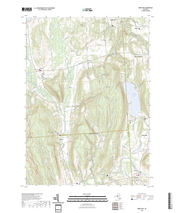
2023 Map of DeRuyter
USGS Topo · Published 2023About this map
Fabius and DeRuyter anchor this transition of the New York landscape where the headwaters of several major creek systems emerge from the high ground of Morgan Hill and Arab Hill. The map meticulously records the many family and community burial grounds that dot these uplands, including Old Fabius Cem, Stockham Hill Cem, and the Merchant Smith Cem near the shores of DeRuyter Reservoir.
Find a feature on this map
97 named features on this map. Tap any name to fly to it.
Don’t see what you’re looking for? This feature index may not catch every label — zoom into the map to look around manually.
Map Details
Editions of this 2023 DeRuyter Map
This is the sole edition of this map. No revisions or reprints were ever made.
Other maps of this area

1897 · Cazenovia
USGS Topo · 1:62,500

1899 · Cazenovia
USGS Topo · 1:62,500

1900 · Tully
USGS Topo · 1:62,500

1903 · Cortland
USGS Topo · 1:62,500

1904 · Pitcher
USGS Topo · 1:62,500

1942 · Oran
USGS Topo · 1:24,000

1943 · Jamesville
USGS Topo · 1:31,680
1943 · Oran
USGS Topo · 1:31,680
1943 · Tully
USGS Topo · 1:24,000

1943 · De Ruyter
USGS Topo · 1:24,000