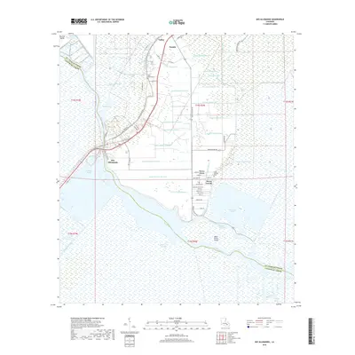
2018 Map of Des Allemands
USGS Topo · Published 2018About this map
Bayou des Allemands serves as the central artery for this corner of South Louisiana, where the water-bound culture of St. Charles and Lafourche parishes is clearly defined. The settlement of Des Allemands sits at the junction of several waterways and the historic Old Spanish Trl, reflecting a landscape deeply shaped by drainage and transport. To the north, the community of Paradis and the hamlet of Vallier are bordered by an extensive grid of man-made canals, such as Canal Number Three and Canal Number Twenty-two, illustrating the engineering required to manage this low-lying wetland environment.
Find a feature on this map
77 named features on this map. Tap any name to fly to it.
Don’t see what you’re looking for? This feature index may not catch every label — zoom into the map to look around manually.
Map Details
Editions of this 2018 Des Allemands Map
This is the sole edition of this map. No revisions or reprints were ever made.
Other maps of this area

1891 · Hahnville
USGS Topo · 1:62,500

1892 · Lac Des Allemands
USGS Topo · 1:62,500

1892 · Cut-Off
USGS Topo · 1:62,500

1892 · Houma
USGS Topo · 1:62,500

1932 · Lac Des Allemands SE
USGS Topo · 1:31,680

1932 · Houma NE
USGS Topo · 1:31,680

1932 · Hahnville NW
USGS Topo · 1:31,680

1932 · Lac Des Allemands NE
USGS Topo · 1:31,680

1932 · Hahnville SW
USGS Topo · 1:31,680

1932 · Hahnville NE
USGS Topo · 1:31,680