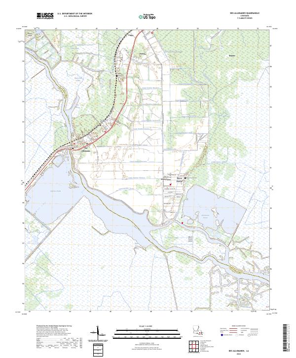
2024 Map of Des Allemands
USGS Topo · Published 2024About this map
Bayou des Allemands serves as the central artery for this marsh-rich landscape on the border of St. Charles and Lafourche Parishes. The settlement of Des Allemands anchors the waterway, positioned where Old US Hwy 90 and the railroad once shaped local transit. The map reveals an intricate network of drainage and transport canals, ranging from Canal Number Twenty-two in the north to the Burchell Canal in the southeast.
Find a feature on this map
84 named features on this map. Tap any name to fly to it.
Don’t see what you’re looking for? This feature index may not catch every label — zoom into the map to look around manually.
Map Details
Editions of this 2024 Des Allemands Map
This is the sole edition of this map. No revisions or reprints were ever made.
Other maps of this area

1891 · Hahnville
USGS Topo · 1:62,500

1892 · Lac Des Allemands
USGS Topo · 1:62,500

1892 · Cut-Off
USGS Topo · 1:62,500

1892 · Houma
USGS Topo · 1:62,500

1932 · Lac Des Allemands SE
USGS Topo · 1:31,680

1932 · Houma NE
USGS Topo · 1:31,680

1932 · Hahnville NW
USGS Topo · 1:31,680

1932 · Lac Des Allemands NE
USGS Topo · 1:31,680

1932 · Hahnville SW
USGS Topo · 1:31,680

1932 · Hahnville NE
USGS Topo · 1:31,680