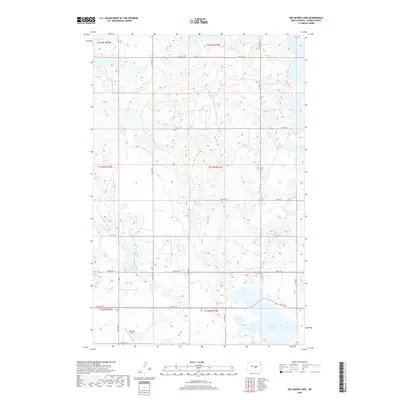
2018 Map of Des Moines Lake
USGS Topo · Published 2018About this map
Des Moines Lake and the smaller Sink Lake dominate the southeastern corner of this Kidder County landscape, set within the characteristic pothole region of North Dakota. The area is defined by a sparse, grid-like network of rural roads such as 19th St SE and 37th Ave SE, which serve the expansive agricultural tracts and prairie terrain. Near the southern boundary, Whitman Field serves as a distinct terrestrial landmark amidst the numerous unnamed seasonal wetlands and depressions that dot the sections. This 2018 survey illustrates the persistent township and range system, with boundaries like t143n r71w clearly delineating the surveyed sections that have organized this territory since its initial settlement.
Find a feature on this map
23 named features on this map. Tap any name to fly to it.
Don’t see what you’re looking for? This feature index may not catch every label — zoom into the map to look around manually.
Map Details
Editions of this 2018 Des Moines Lake Map
This is the sole edition of this map. No revisions or reprints were ever made.
Other maps of this area

1952 · New Rockford
USGS Topo · 1:250,000

1956 · New Rockford
USGS Topo · 1:250,000

1971 · New Rockford
USGS Topo · 1:250,000

1972 · Kunkel Lake
USGS Topo · 1:24,000
1972 · Horsehead Lake
USGS Topo · 1:24,000

1972 · Lake Williams
USGS Topo · 1:24,000

1972 · Robinson
USGS Topo · 1:24,000
1972 · Pettibone
USGS Topo · 1:24,000

1972 · Des Moines Lake
USGS Topo · 1:24,000

1978 · Wagon Wheel Hill
USGS Topo · 1:24,000