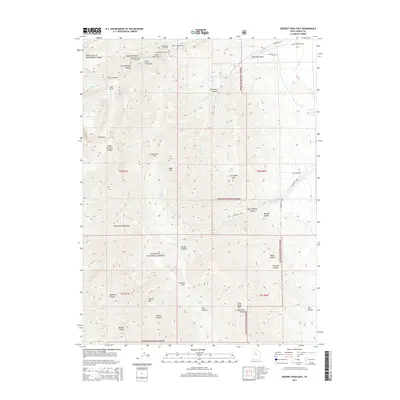
2014 Map of Deseret Peak East
USGS Topo · Published 2014About this map
The Stansbury Mountains define this high-elevation landscape within the Wasatch National Forest in Tooele County. The topography is marked by significant drainages and peaks, including Bald Mtn and Slate Rock Peak, which overlook a series of deep canyons like South Willow Canyon and Indian Hickman Canyon. Recreational and utilitarian land use is evident through numerous established sites such as the Boy Scout Campground, Intake Campground, and the Medina Flat Trailhead. The presence of the Mining Fork of South Willow Canyon suggests the area's historical connection to resource extraction. To the east, the terrain transitions into complex hollows and washes, including Box Elder Wash and Morgan Hollow, illustrating the watershed patterns that feed into Hickman Cr and Barlow Cr.
Find a feature on this map
58 named features on this map. Tap any name to fly to it.
Don’t see what you’re looking for? This feature index may not catch every label — zoom into the map to look around manually.
Map Details
Editions of this 2014 Deseret Peak East Map
This is the sole edition of this map. No revisions or reprints were ever made.
Other maps of this area

1885 · Tooele Valley
USGS Topo · 1:250,000

1918 · Stockton
USGS Topo · 1:62,500

1953 · Tooele
USGS Topo · 1:250,000

1955 · Timpie
USGS Topo · 1:62,500

1955 · Deseret Peak
USGS Topo · 1:62,500

1955 · Grantsville
USGS Topo · 1:24,000

1955 · Stockton
USGS Topo · 1:62,500

1955 · Tooele
USGS Topo · 1:250,000

1979 · Rush Valley
USGS Topo · 1:100,000
1979 · Tooele
USGS Topo · 1:100,000